AST updates geospatial information of the transmission network by laser scanning from a helicopter
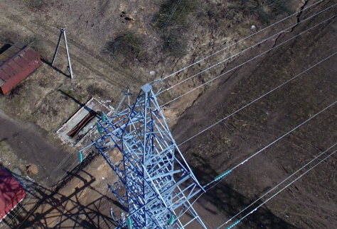 The Latvian transmission system operator AS Augstsprieguma tīkls (AST) plans to perform laser scanning and thermal imaging of the entire Latvian transmission network by 2022, by collecting technical data from a helicopter. Over the next week, flights are planned in Riga, Cesis, Bauska, Jurmala, Olaine, Ogre, Jelgava, and in the areas surrounding these cities.
The geospatial information of the AST transmission network needs to be clarified, as the construction of high-voltage power transmission lines was started with the establishment of AST in 1939; however, since 1960, a 330 kV network has been operated alongside the 110 kV network. Over time, several power transmission lines have been reconstructed, part of the support and wiring sections have been changed in most lines, the topography and environment in the protection zones have changed, and crossing and parallel communications have been reconstructed. Laser scanning and thermal imaging of the transmission network is planned for obtaining information on the transmission network in Latgale, Zemgale, part of Vidzeme, and South Kurzeme by the end of the year.
After laser scanning and thermal imaging of power lines, AST will obtain up-to-date, verified, and realistic visual and geospatial information to assess the condition of the existing network protection zones and routes, as well as up-to-date information on unwanted objects, obstacles, unwanted vegetation, overgrowth and its dimensions in the power line routes; this will also allow the detection of thermal defects at the line junctions.
All information obtained will be processed and integrated into AST’s geographic information systems, recording the height and volume of bushes on line routes, the widths of routes in line corridors, geographical coordinates and slopes of supports, conductor sag, wire overlap dimensions in relation to the ground, and other data relevant to the operation of the transmission network. Laser scanning will also allow to record the condition of the power line at a particular moment and detect violations of the Protection Zone Law.
At present, AST obtains this information from what is observed during personnel visits, but it is often the subjective vision of the personnel involved and of low accuracy, as topography and distances are often described by visual observation. This type of information acquisition consumes a lot of personnel and material resources.
In assessing the amount of information required for the maintenance of the transmission network, AST analysed several technical options for obtaining the information, including the use of drones. The use of a helicopter was recognized as the safest and most cost-effective method for laser scanning and thermal imaging of the transmission network, considering the amount of work to be performed.